Telecom marketing, advertising and innovation

What's possible for telecom leaders

Network monetization
In addition to leveraging CAMARA-ready APIs, our platform offers a comprehensive toolkit for Network-as-a-Service (NaaS). With our advanced APIs, MNOs gain access to a wider range of features and functionalities.

Subscribers' lifetime value
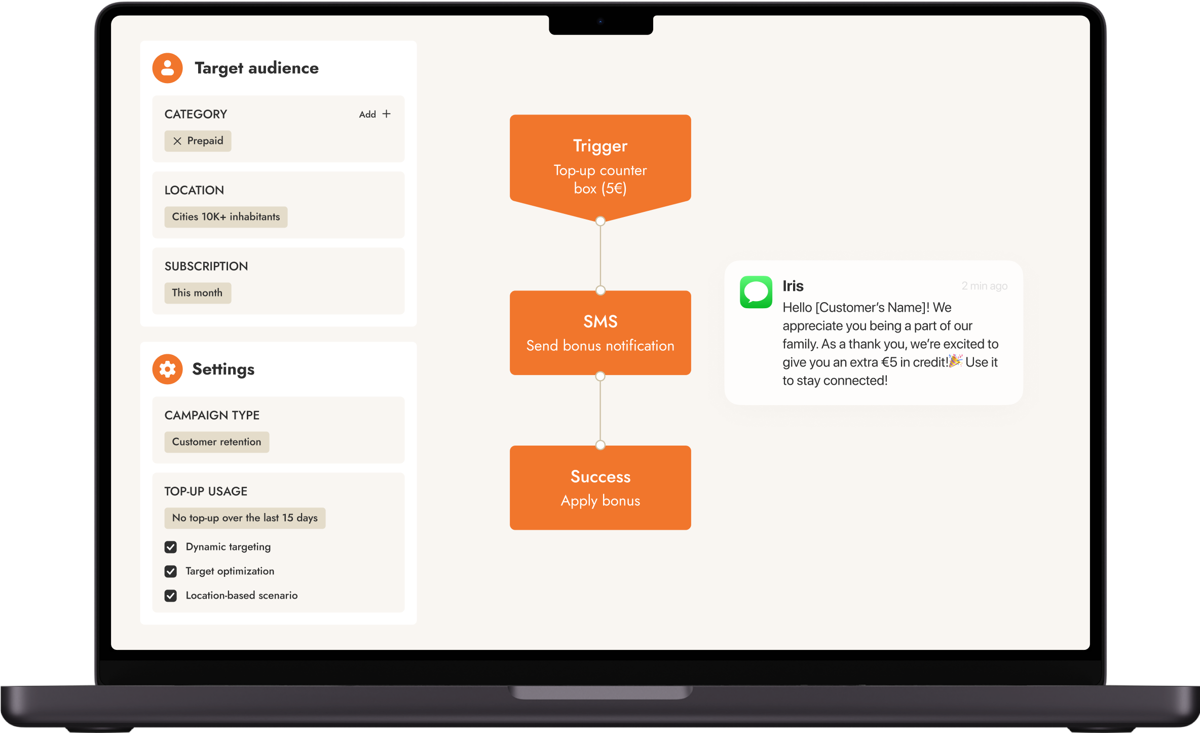
Leverage smart segmentation, contextual insights, AI-based predictions, and workflow automation to create impactful CVM marketing campaigns and offer stellar experiences to your customer base.

Geotargeted advertising
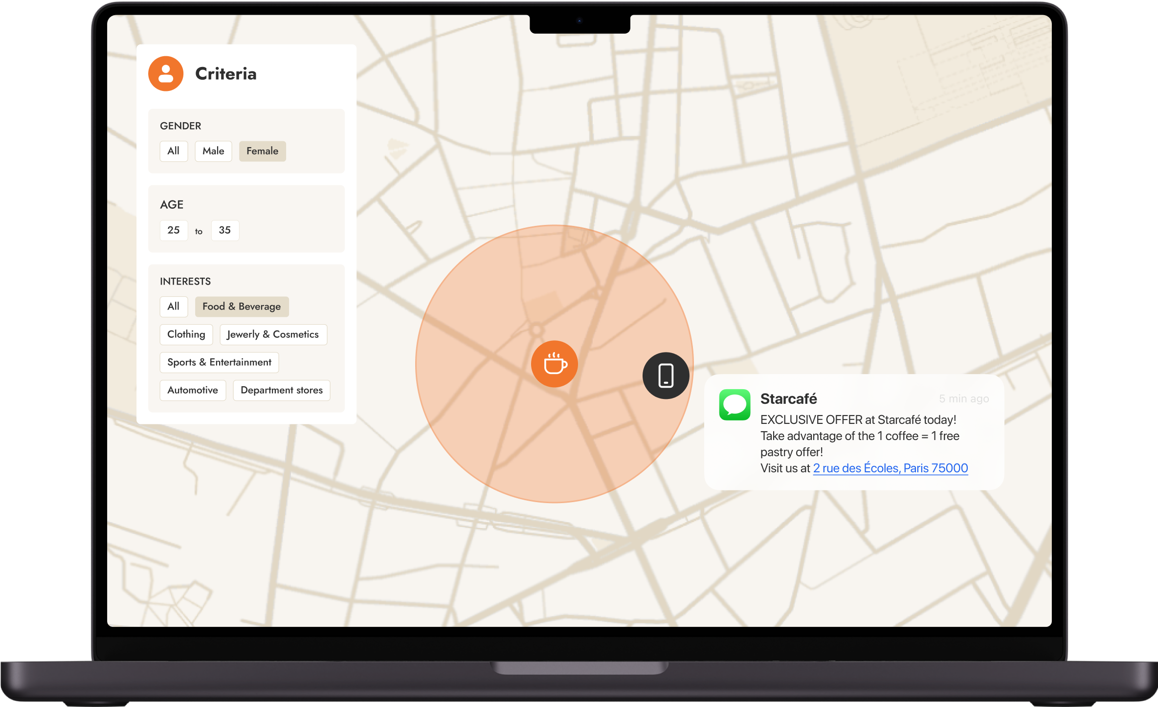
In a cookieless world, telcos provide a hyper-targeted marketing reach via high-engagement channels, allowing brands to reach customers in a personalized and contextualized way the instant they enter a defined area.

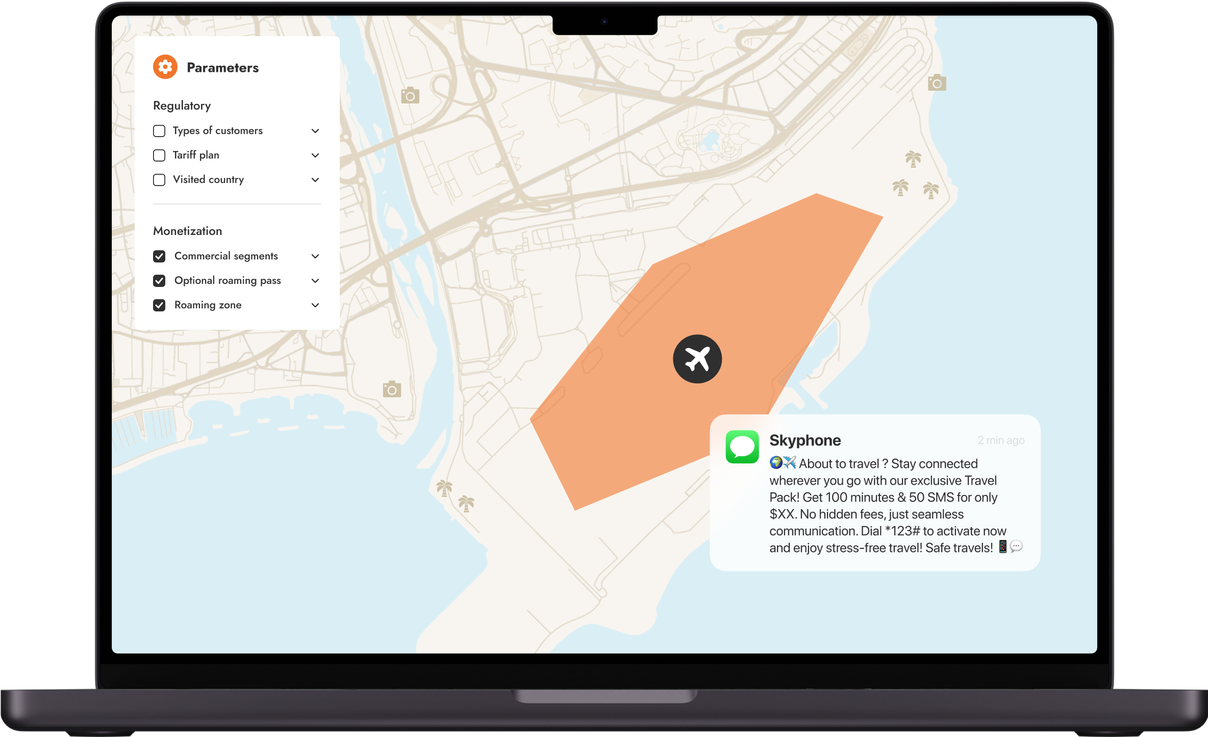
Roaming opportunities
Target the right people at the right time, including silent roamers, and run highly targeted campaigns, such as welcome-back SMS, roaming passes and surveys, from before departure to arrival to increase top-line revenue from day one.

Smarter cities
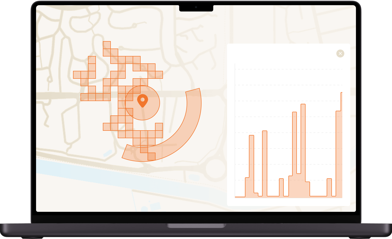
Our platform analyzes foot traffic patterns and transport routes, helping cities refine services and improve mobility. With a digital twin of their database, telcos gain rich insights and anonymized data to create impactful studies and reports for smart city initiatives.
Promising IoT use cases
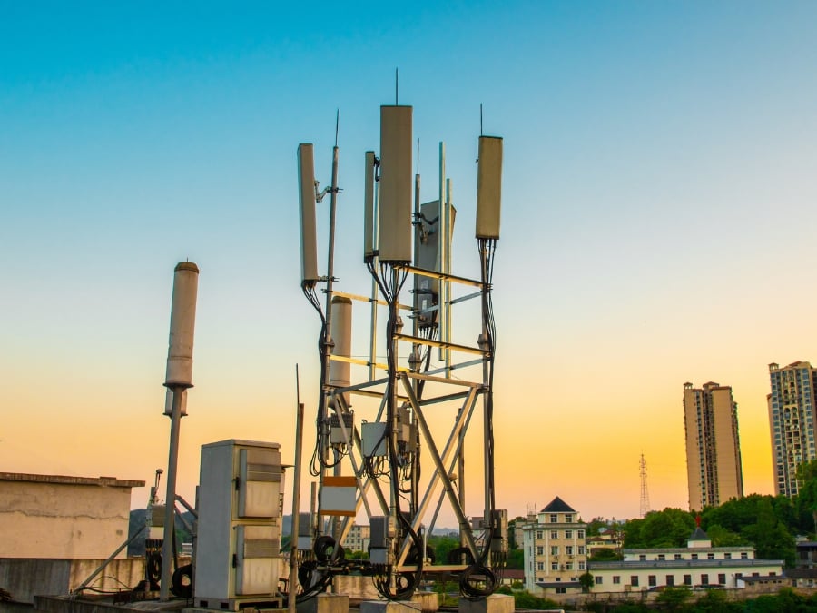
5G SA significantly enhances network capacity and spatial accuracy, supporting the next wave of IoT connections. This presents a great opportunity for mobile network operators to open their networks and serve new verticals like industry 4.0 and connected vehicles.
The Telco Business Suite
Making telcos marketplace-ready
The telco metadata advantage
moreIn contrast to over-the-top (OTT) vendors, CSPs have become trusted providers of consumer data by ensuring data privacy and enabling third-party services safely. Thanks to telcos’ vast amount of data and high-engagement channels, they can roll out cookie-free and privacy-friendly data-driven solutions for advertising, credit risk and intelligence. By playing by the rules, CSPs minimize the risk of data breaches and compliance violations, while safeguarding their reputation, unlocking new business opportunities, and building a competitive edge. → Watch the video series
For example, True Digital uses micro-segmentation to label its subscribers with more than 400 tags that are demographic, geographic, behavioral, and interest-based, and then uses real-time triggers to decide the best moment to interact with customers and deliver new offers. They then anonymizes this data and offers it to other companies that want to advertise on high-engagement channels such as SMS, video streaming and e-wallet apps. The company also leverages geolocation to conduct footfall and mobility analyses to help businesses make better decisions about where to open new shops or branches. → Watch the success story
Promising IoT use cases
moreIn connected factories, geolocation enables the tracking and management of assets like vehicles, containers, and equipment, providing real-time location data, geofencing, and analytics to optimize asset utilization and logistics.
Insurance telematics leverages geolocation to offer usage-based insurance premiums based on driving habits, ensuring accurate data through SIM cards or mobile phones.
Connected drones utilize 5G's centimeter-level positioning accuracy to confirm drone locations within authorized air corridors, with Vodafone developing drone services, including a drone coverage API and location services, to help operators plan flight paths and comply with regulations.
Mobile Private Networks
moreOne significant opportunity for CSPs lies in private 5G networks, which greatly improves accuracy, response time, positioning, and control of IoT devices compared to GPS and Wi-Fi. These improvements are critical for applications that require real-time processing and rapid response –autonomous vehicles, industrial automation, and augmented reality (AR), for example. For many years, GPS has been used to deliver geolocation capabilities in industrial applications, pinpointing a device’s position with an accuracy of 10 to 20 meters. But GPS is limited because it only works outdoors and suffers from high latency. 5G geolocation cuts latency to a millisecond and can track a device with an accuracy of 1 meter or less. Indeed, if a factory or port has a high density of 5G cell sites, accuracy of 30 centimeters is possible.
5G private networks can also support a higher number of connected devices within a given area, and the networks are more secure than Wi-Fi networks, which require passwords.
Another advantage of private 5G over Wi-Fi is that its availability indoors and outdoors ensures continuity of coverage. These features give enterprises more control over who has access to the network.
Tapping the enterprise market is key
moreBy implementing 5G network slicing, CSPs can support multiple virtual networks with very different characteristics using the same physical infrastructure. So, if an enterprise requires multiple slices for different applications (for example, machine-to-machine communications for tracking IoT devices and ultra-reliable, low-latency communications for a mission-critical application like robotics), CSPs can tailor solutions to meet performance, security, and reliability requirements.
5G SA can have an even greater impact when operators leverage advanced technologies like beamforming, multi-cell round-trip time (RTT), and millimeter waves to locate devices more accurately. The technology also empowers mobile operators to open their network infrastructure to developers through APIs using the Network Exposure Function (NEF). This enables new network-as-a-service and network-as-a-platform offers, which can lead to revenue growth.
Exposing network capabilities through API
moreCAMARA is an open-source initiative that standardizes telecom network APIs, making network capabilities easily accessible to businesses and developers worldwide.
At Intersec, we fully support CAMARA APIs in three main categories: Location Services, Authentication & Fraud Prevention, and Device Information. Our cloud-native Agora platform is compatible from 2G to 5G, adheres to 3GPP standards, and scales efficiently. Beyond mature APIs, we are also ready to support emerging CAMARA API candidates, leveraging advanced mobility analytics like residence and workplace detection, trajectory analysis, and multi-zone geofencing.


Featured content
.png)
Intersec Unveils 24 CAMARA-Ready APIs to Accelerate Telco Innovation
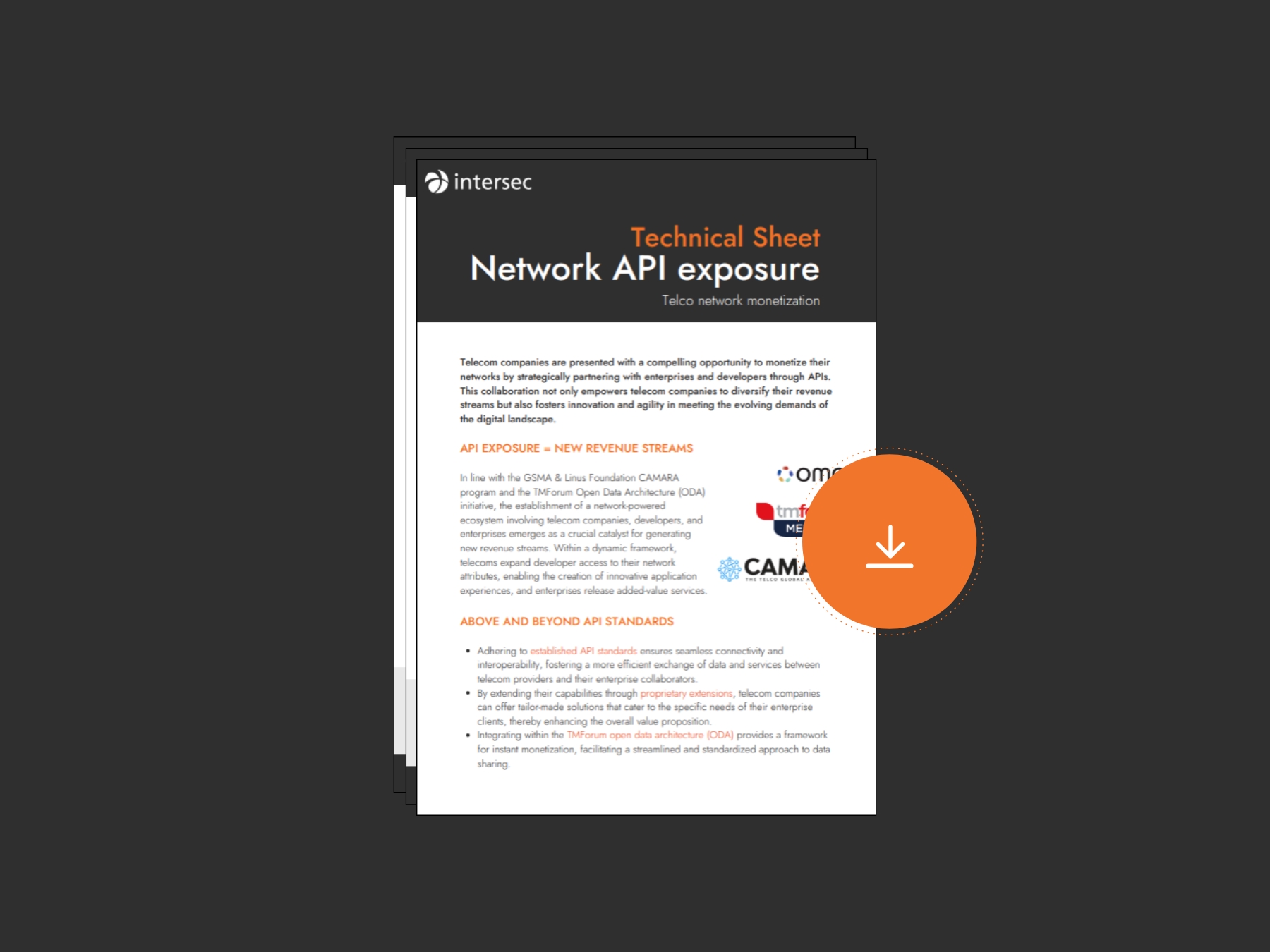
Technical sheet - Network API Exposure

Telco marketing & innovation use cases
Network exposure through APIs

Telecom network and service exposure enables secure, API-based access to 5G network capabilities—such as activity, mobility, and advanced data services.
Digital customer journey

Leveraging smart segmentation, contextual insights, AI-based predictions, and workflow automation, telcos can create impactful marketing campaigns and offer stellar experiences to their subscriber customer base.
Location-based advertising

In a cookieless world, telcos provide a hyper-targeted marketing reach via high-engagement channels, allowing brands to reach customers in a personalized and contextualized way the instant they enter a defined area.
Roaming monetization

Roaming revenues have been hit hard in recent times. Fast Data is a powerful ally that can enable visibility into how roamers behave, helping telcos formulate data monetization strategies.
5G positioning opportunities

With the wealth of location data they collect, telecommunication companies are in the position to compete on equal terms with the GAFA players thereby, turning their 5G investment into tangible results.
Smart Cities

Thanks to mobile and/or Wi-Fi data, it is now possible to have more granular insights regarding security, traffic flow, IoT, ecology, and many other cases. These analysis are of great value prior to refurbishing an area or reorganize a transportation path for instance.
Get started with Intersec

Some of our prestigious clients


.webp)

.webp)