Civil Protection: Technology for Safety and Resilience
.png)
What's possible for civil protection
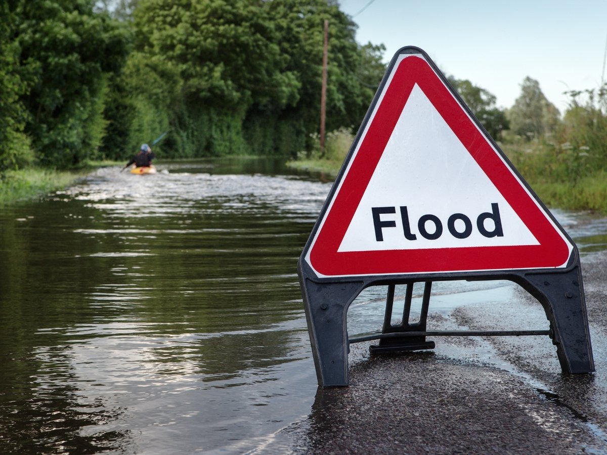
Early warning
Early warning involves detecting hazards and disseminating information for effective response. Intersec processes location-specific data for public safety, offering a comprehensive view and advanced MHEWS with monitoring, alerting, and response, supporting the UN's EW4all initiative.
.jpg?width=6000&height=4000&name=pexels-ono-kosuki-6000157%20(1).jpg)
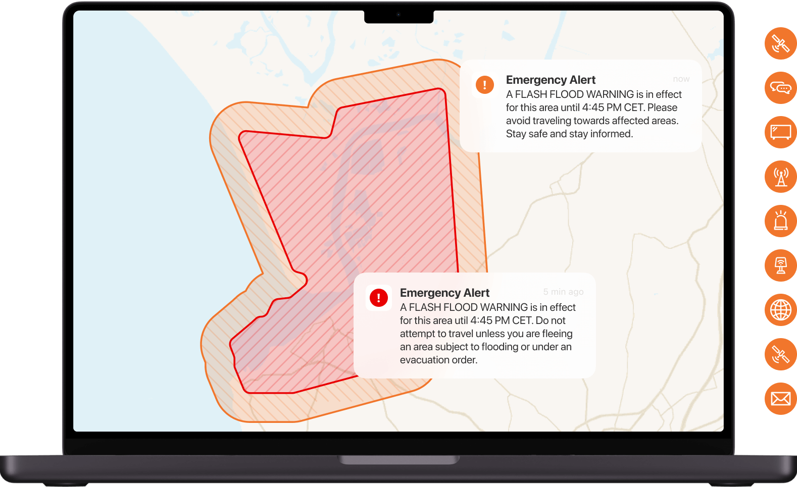
Public alerting
It takes more than a text to keep people safe. We advocate a multichannel approach, combining cell broadcast and location-based SMS technology, and extending beyond telecom channels, to ensure nearly 100% population coverage. Our public warning solutions currently cover 400 million people worldwide.

Asset management
As soon as an incident is detected, our comprehensive solutions enable crisis managers to swiftly activate their standard operating procedures with ease and efficiency, and promptly inform relevant assets. Additionally, they can send timely, contextualized messages to people at risk during critical situations.
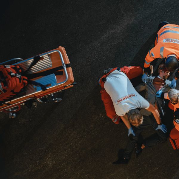
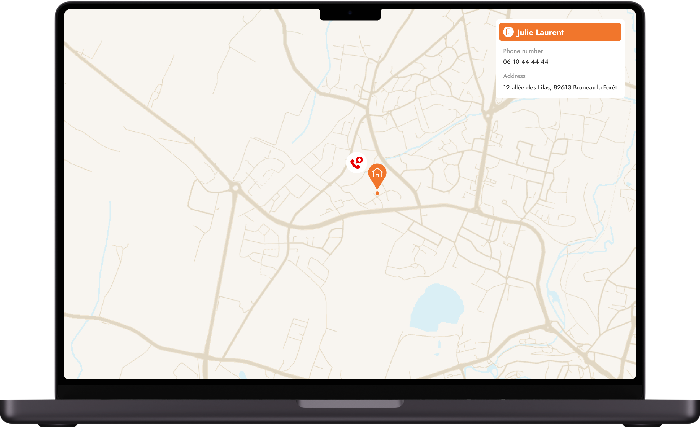
Emergency calls
Our emergency caller location and routing solution leverages network-based plus handset-based location techniques and Advanced Mobile Location (AML) available data, to provide emergency services with critical, certified, up-to-date information and make the most of it in all circumstances.
The GeoSafe Public Safety Software Suite
The data and tools that matter to you
Ready-to-use applications from Day 1
moreThrough open data, our solutions offer a dynamic cartographic display that enhances situational awareness, ensuring users see data specifically relevant to their unique crisis management needs. With a ready-to-use catalog of layers, public safety stakeholders can easily pick and choose the specific data they want to display. Our solutions allow seamless integration with any open data source through APIs, empowering users to access and analyze a wealth of information of interest to them to enhance their decision-making capabilities.
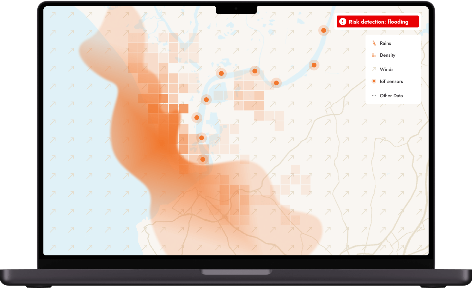
Scalable to address your unique reality
moreIntegrating closed-source data tailored to specific contexts can further enhance the management of emergencies. By incorporating data from external systems, such as weather forecasting subscriptions, IoT sensors, or specialized maps, users can access highly accurate and relevant information to their unique realities. This flexibility ensures that the system adapts to the specific needs and challenges of the user, providing a comprehensive and adaptable solution for enhanced situational awareness.
End-to-end crisis management with network data
moreTo achieve the most comprehensive mission-critical communications, integrating network data from Mobile Network Operators (MNOs) is a crucial step. By tapping into the vast network of MNOs, crisis managers access a digital twin of the in-situ field situation, in real-time and at scale to guide field operations and generate rapid decisions. Moreover, as people increasingly rely on mobile devices for information and communication, leveraging MNO data ensures that communications remain relevant and effective in the long term. By combining the power of open data, closed-source data, and network data, our solutions offer unparalleled reach and effectiveness in emergency management.

Featured content

Public Warning Systems: Intersec launches accessibility frameworks to remove barriers to global adoption


Civil protection use cases
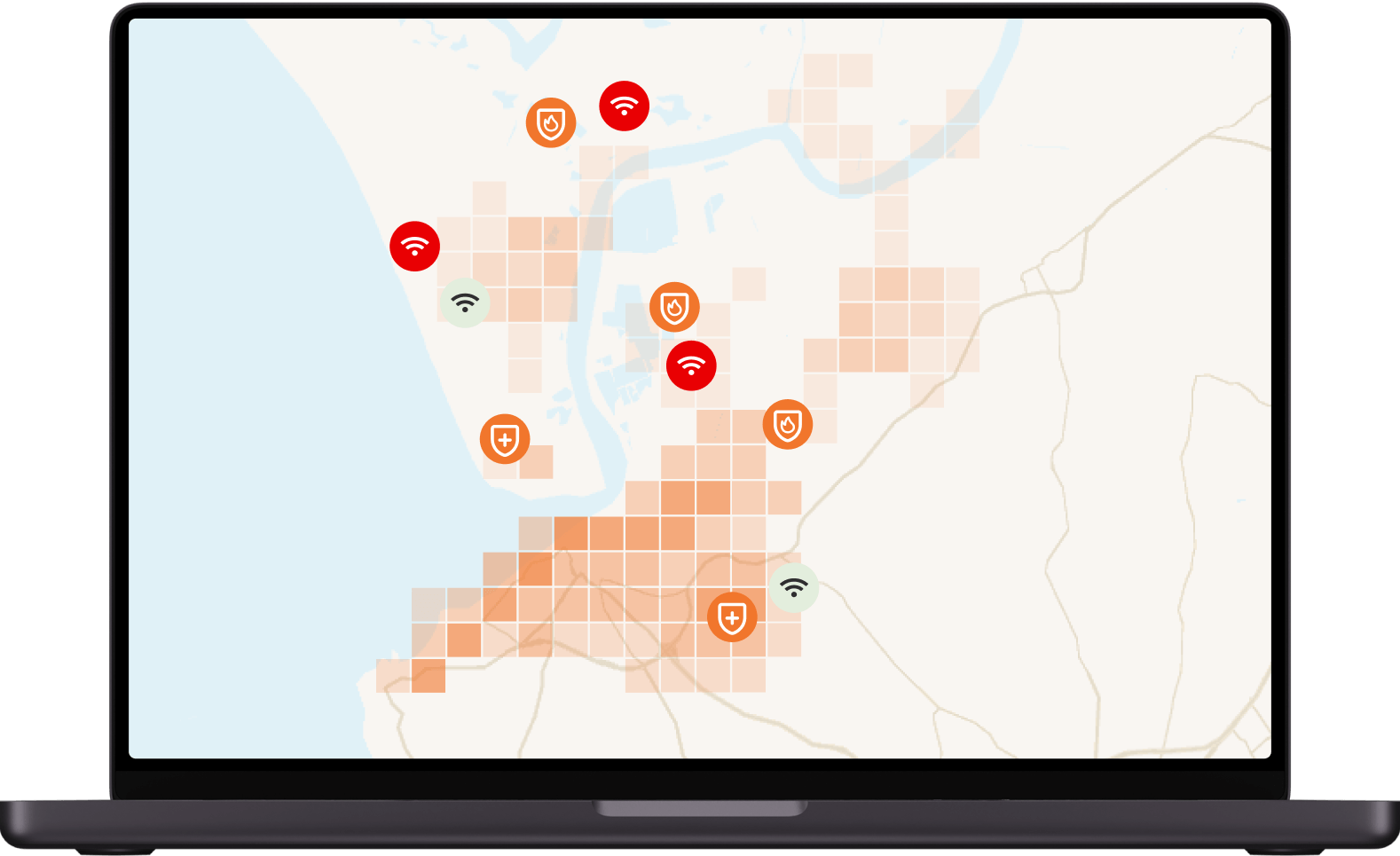
Situational awareness

Our situational awareness instruments serve both authorities and private organizations by providing crisis managers with a real-time digital twin of the in-situ field situation.
Mass notification

Intersec provides a comprehensive, multi-channel application specifically designed for emergency mass notifications to enhance the reach and effectiveness of alerts for individuals at risk.
Incident response

In case of an incident, closely monitor ongoing situations and coordinate your communications with field agents and at-risk communities.
Emergency call location

Our emergency call location solution combines multidimensional cellular device locating capabilities to provide PSAPs with critical, certified, up-to-date location information, for all callers..
Get started with Intersec

Some of our prestigious clients


.webp)


.webp)