 Driving Business Value with Location Intelligence" />
Geolocation data: providing Telco operators with one of their best sources of statistics… and developmentTelco operators are constantly looking for more, better and quicker ways to exploit their networks’ user-generated data, both to optimize their own activities and to create new business models and income.
Geolocation provides a highly effective way of improving customer insight and developing new income alongside the core business.
Today’s brand new geolocation tools based on Big Data, mass monitoring and geofencing technology allow huge volumes of data to be automatically and swiftly turned into an aggregated and anonymous stream of information on places, individuals and times. This information can be of great value for an operator, a city or an industrial. Whereas raw data streams are generally extremely voluminous (up to one million events per second), the statistical information processed in this new way becomes more easily exploitable, is readily shared with external systems, and can be integrated into data warehouses.
What can be done with this “refined” data, which now represents a rich lode of insight?

Coupled with profile information, and provided it is rendered anonymous, mobile customers’ geolocation data remains one of the best sources of statistics for operators and their marketing and business development teams:
- cost-effective: it cuts the cost of conducting traditional surveys, which rely on time-restricted questionnaires and samples;
- precise: it circumvents the methodological biases of the aforementioned surveys, and the sample sizes are extremely large (generally more than 10% of the whole population);
- real-time: whereas traditional geolocation players spent days converting raw data into exploitable information, today’s new solutions deliver results in a matter of minutes, if not seconds. Operators are consequently entering the Fast Data age. Alongside the volumes that Big Data brings, they are able to analyze that data in real time rather than staggered over time in “batches”.
Segmentation, mobility, the buyer's journey… Analyses based on this kind of data offer a highly effective way of improving customer insight and developing new income alongside the core business.
In this white paper, we demonstrate why it is consequently vital to use all available data, ensuring data is not left lying dormant. More importantly, we explain how geolocation technology and tools can be used to gather and “refine” this data. We also explore just what can be gained from exploiting this data and examine which opportunities are there for the taking, from enhancing customer insight to assisting with major operational decisions.
1. Making raw massive data more easily exploitable
Geolocation aggregates vast quantities of data, combining attributes with a geographic zone. Once data has been filtered or "refined", it then undergoes on-the-fly analyses using pre-determined criteria to render it exploitable. In a sector rife with innovation, the location-based data generated today is now more precise than ever. Better still, it can also be coupled with customer profile data.
WHAT IS GEOLOCATION?
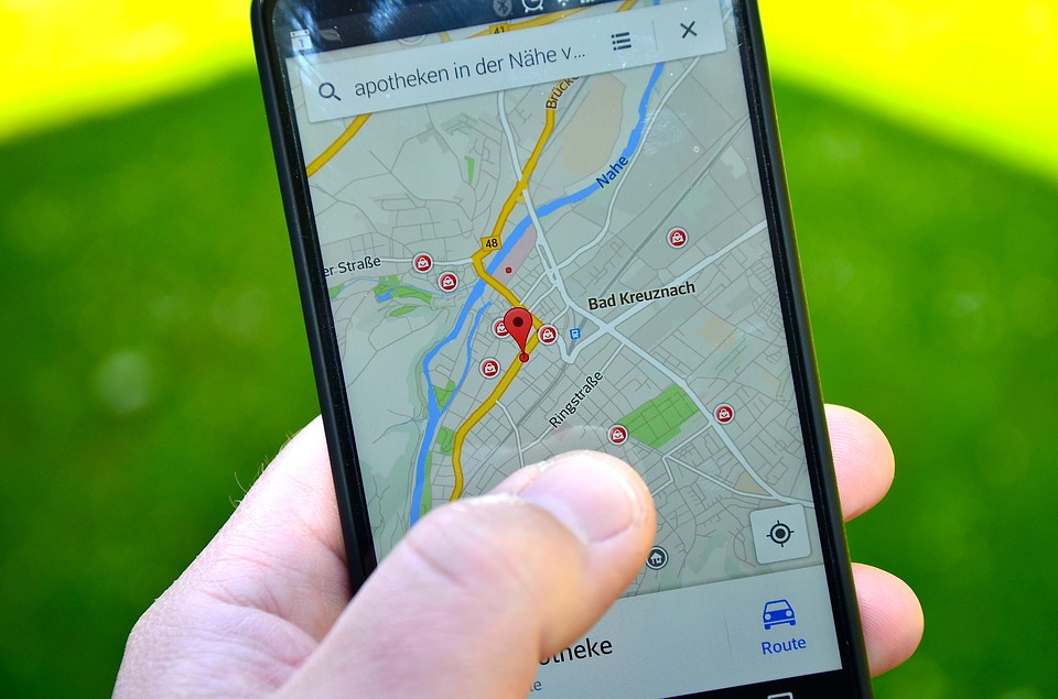
Geolocation combines various technologies that use geographical coordinates to pinpoint single elements on a map, such as people, vehicles or, indeed, any kind of object. There are different ways of achieving this among which: using a GPS (Global Positioning System), the mobile or Wi-Fi position of a device, or an IP address.
Geolocation software collects and analyses the raw massive data generated by mobile networks. These technical data are produced to enable the network to perform yet they can be exploited to business usages. For instance, they can help count the number of people present at a specific point of interest at a given time.
It then structures that data to extract exploitable information from it, such as visiting frequency, visitor profile, visitor paths, etc., notably for use by marketing teams.
A geolocation solution that has been configured to track a specific flow of people at a specific location, for example, can generate insights on visitors’ starting points and destinations, the means of transport they use and their profile (travelers, workers, locals, etc.). Just the kind of information a transportation company could then use to determine the best possible location for the arrival and departure of a new line, along with the frequency of the service and the fare scale.
The most advanced solutions use Big Data to crunch huge volumes of data, structured or not, as well as segmenting the population with the help of mass monitoring, machine learning and geofencing – a form of targeted marketing based on geographic zones that individuals enter or in which they are already present. All in compliance with confidentiality and personal data protection regulations.
"Machine learning algorithms improve mobility information quality.”

GEOINSIGHTS CASE STUDY 1: A large urban transport network needed to analyze how its tourist buses were being used; Intersec developed a solution that used a dedicated web-based interface featuring a targeted dashboard to supply the tourist bus team with continuous indicators. GeoInsights was then used to analyze four full weeks of data (800,000 network traces), based on Wi-Fi hook-ups on the 38 buses in use, their GPS positions (19,200km of road) and sales data.
HOW DOES IT WORK?
Raw geolocation data is collected, filtered, aggregated and analyzed on the fly using a process that crunches several gigabytes of data each second with the help of technology such as In Memory Database (IMDB). This data is then stored for use in Business Intelligence-type applications with extremely fast response times.
The geolocation service must have reporting and data intelligence capabilities and allow targeted initiatives to be delivered. Reporting capabilities are vital for managing and monitoring millions of devices, creating widgets and custom indicators for performance monitoring purposes, and lastly cleaning, correlating and visualizing data in a matter of clicks via a dedicated platform. Data intelligence capabilities enable automatic learning algorithms to be used, results to be predicted, and real-time forecasts to be enriched using the continuous flow of data captured by sensors.
All that information is then used to develop initiatives based on flexible triggers (use, location, behavior, etc.). The thus automated workflow predefines rules to guarantee pertinent results (including the message to end-users, communicated via several channels).
What makes the most cutting-edge geolocation tools truly stand out from the crowd? Speed of execution. A few milliseconds are all they need to make the right decision, based on several terabytes of data. This is extremely relevant technology, which combines the efficiency of NoSQL databases with the convenience of both relational databases and in-DB processing.
WHAT TOOLS ARE REQUIRED?
As well as being efficient, solutions must also be easy to use, allowing everyone right across the firm, from marketing teams and HR to those in the finance department, to get up and running without calling in specialized data scientists. All that’s needed is a software platform linked to the various data sources identified. Rendering the data is easy, too, as the tool offers easy-to-use interfaces via which raw or smart queries can be executed.
What makes today’s new geolocation tools, such as GeoInsights, special? Neither substantial changes to the operator’s IS nor any network redesign are required.
Operators already have access to some of these technological layers: sensors to capture information, databases and data lakes, monitoring tools… The technology is out there, the solutions exist, continue to evolve and are readily available; they collect and link both OSS and BSS data, irrespective of the supplier and format, via an extensive directory of connectors. They can operate as stand-alone solutions or alongside existing databases built using more traditional solutions (Hadoop, Spark, etc.).
TECHNOLOGY

Architecture of key components for the GeoInsights solution: exclusive technology steering sound decision-making
The firm gathers and filters raw data from any traditional database. As a turnkey solution, GeoInsights allows users right across the business to design, amend and automate any scenario in a matter of minutes. An intuitive interface makes for extremely easy amendments, requiring no specific technical expertise.
2 – Leveraging value from location data
Geolocation is one of the tools that can be dedicated to enhancing customer insight. There is enormous potential to be harnessed from leveraging the value of refined data: operators can use geolocation data to better tailor their offers to each individual customer, thereby improving the firm’s sales effectiveness, whilst "just-in-time" geolocation through open APIs allows firms to communicate with customers the instant they move into a strategic location.
ENHANCING CUSTOMER INSIGHT
First and foremost, all the information generated by geolocation gives businesses the opportunity to get to know their customers better and find out more about their spending habits and lifestyles. In a firm’s call center, for example, the advisor will see detailed information about the customer he’s chatting to pop up instantly on his screen. Customer insight helps build stronger customer relations, drives customer loyalty and allows offers to be tailored to each individual.
Enhancing customer insight is consequently of great strategic importance, not just for Telco operators but for all the other sectors to whom the processed data is then sold-on. The wealth of monetizable information it provides is likely to interest firms who need to identify different profiles in space and time, be that to more effectively target a communications campaign or to glean a better understanding of what its customers want.

GEOINSIGHTS CASE STUDY 2: One of Paris’s central squares is riddled with dozens of Wi-Fi hotspots. Intersec used GeoInsights to gather, anonymize and crunch four weeks of data to identify: visitor numbers and visiting frequency; visitor profiles (tourists, locals, workers); visitor paths; and the key points of interest (bus station, metro exit point, specific avenue). The aim? Simulate the consequences of reconfiguring the square according to several possible scenarios (more green spaces, additional pedestrianized zones, introduction of one-way systems, etc.), in order to base the final decision on facts.
CREATING INNOVATIVE GEOLOCATION SERVICES
Another potential use for geolocation tools? Interacting with customers the second they set foot in a predefined zone. Known as "geofencing", this real-time solution opens the door to a whole range of innovative geolocation services via APIs that are extremely easy for developers to use.
Geolocation allows lots of innovative services to be easily created via APIs that are extremely easy for developers to use.
Furthermore, the query engine (see the infographic on page X), which is a state machine capable of placing an operator’s entire customer database into a pre-established scenario (such as a marketing campaign) in real time, offers a high performance solution with the creation of complex scenarios in real time. Firms have the ability, for example, to adopt a cross-channel approach by targeting all the individuals under a certain age who have used a specific number of gigabytes over the course of the day and who are in close proximity to a specific store, pushing them product news, deals and promotions, etc. This is the kind of information that marketing, and advertising teams are eager to get their hands on to effectively target their campaigns. Another golden opportunity for operators to monetize their data, rendered exploitable by the geolocation tool.

GEOINSIGHTS CASE STUDY 3: GeoInsights has already been adopted by a leading French Telco operator (20 million subscribers and an ultra-dense network). The solution handles over six billion events each day and retrieves the subscriber’s location in under 1ms. Whenever there are insufficient sensors to capture precise location data, Intersec supplies an exclusive "Geosensor" that retrieves all the location data directly from the core network in real time. From one-off studies to industrialised reccurent ones, this MNO uses GeoInsights to propose high value insights to its B2B customers.
MAKING THE RIGHT OPERATIONAL DECISIONS AT THE RIGHT PRICE
Lastly, geolocation can also be a veritable Business Intelligence tool, helping improve the quality of the operator’s network. Data gleaned from a mobile network can help Telco operators identify possible problems within their cellular networks. It can, for example, highlight traffic peaks in specific cells on specific days of the year. It can also flag up cells that are not up to date: if a subscriber’s phone is connected to an antenna, coupling the information with Wi-Fi or GPS data can help the operator realize that the subscriber’s phone has switched to a different antenna, several kilometers away.
On a broader level, geolocation software can help pick up on certain network components being under- or over-used. It can even act as a substitute for a mobile operator’s central database in order to prevent overloading. These databases, known as HLRs or HSSs (Home Location Register/Home Subscriber Server), are not only vital – an outage can end up blocking the whole network, but also fragile, as traffic is intense.
Operators can notably use all this information to guide their decisions about network and antennae roll-out, all at minimum cost. Customer connection problems are detected more quickly, enabling proactive action to be taken. Operators can easily prioritize their next-generation access networks or even identify fraudulent activity. Take cloned SIM cards, for example. Using geolocation solutions, operators can instantly detect abnormal traffic generated by identical SIM cards, and immediately disable the line. Problems can also arise when prepaid SIM cards are purchased using a false identify and then used to call premium rate numbers overseas. This kind of abnormal activity is flagged up to the local operator in a matter of minutes, whereas previously it could have taken weeks, resulting in huge financial loss.
Super-speedy and highly responsive, today’s new geolocation solutions can consequently help operators be more competitive, and can be seamlessly integrated into traditional IT architectures, enriching them with new features.
THE PASSIVE/ACTIVE ORCHESTRATION LOGIC
The aim of passively collecting data is to gather huge amounts of information from a variety of different sources (Wi-Fi, mobile, sensors, LoRa, Sigfox, RFID, etc.), without overloading the network with active queries.
The "passive geolocation" concept is underpinned by the principle of "listening in" to continually extract location information (events linked to a subscriber’s activity, such as sending and receiving SMSs, emails and calls, Internet browsing, synchronizing apps with the network, turning the phone on and off, etc.). The more frequently these events occur, the more precise the monitoring is. So, why “passive”? Simply because it doesn’t generate any specific network activity. This method can be used to gather data both on traditional mobile networks (2G, 3G, 4G, 5G) and on Wi-Fi networks.
Take, for example, a regional government that wants to push an alerting message to everyone who comes within a 100-meter radius from a fire. In passive mode, the real-time engine knows where subscribers are located at all times. If an event indicates that a subscriber is approaching the area of interest, an orchestration engine triggers active queries to obtain precise information in real time. The closer the individual gets to the zone (5km away, then 1km, for example), the more frequent the active queries become (say every 5 minutes, then every 10 seconds) to be sure to capture the exact moment when the individual enters the area.
This kind of mechanism can be activated to boost the geofencing detection rate when the type and number of event sources, the geography of the target area and the operator’s cellular network fail to offer a sufficient level of precision.
CONCLUSION
In the age of Big Data and faced with heightened competition from OTTs, Telco operators are constantly looking for innovative and "smart" solutions to optimize their businesses and enhance their operational excellence. Today’s new geolocation tools, which generate refined data in near real time, offer a particularly relevant solution.
The stakes are high: Telco operators may want to consider making their software suppliers their business partners with a view to gaining access to refined data which they could then sell on to their B2B customers.
.jpg)
Editorial team
LinkedinThe Intersec editorial team is made up of professionals who share expert insights on AI-powered innovations, mission-critical communication solutions, and 5G location intelligence across civil protection, homeland security, and telecommunications.

Market Outlook: Hot Topics in the Telco Industry
Discover how telecoms can lead the AI revolution
From predictive maintenance to smarter customer support, AI isn’t just hype, it’s transforming core telco operations. Find out how the latest breakthroughs are reshaping the industry.


.webp)


.webp)