Telecom regulatory affairs: beyond compliance

What's possible for telecom regulatory affairs

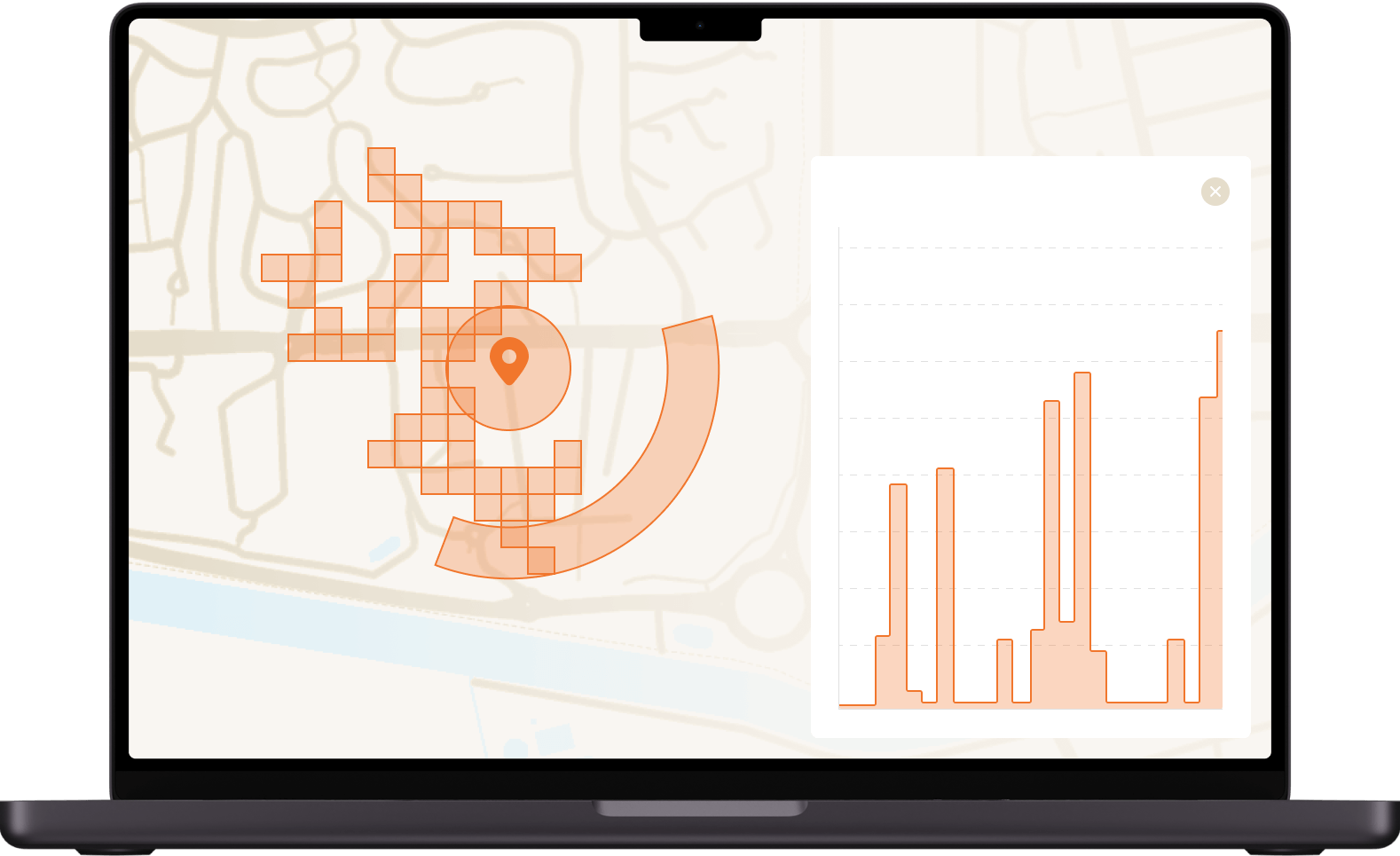
Geolocation standards
Intersec plays a critical role in geolocation standards by aligning with key organizations such as 3GPP, OMA, ETSI, and TM Forum. Our platform complies with 3GPP standards for mobile location data, provides API compliance with OMA standards, and participates in ETSI to enhance telecom compatibility and security.

Authority cooperation
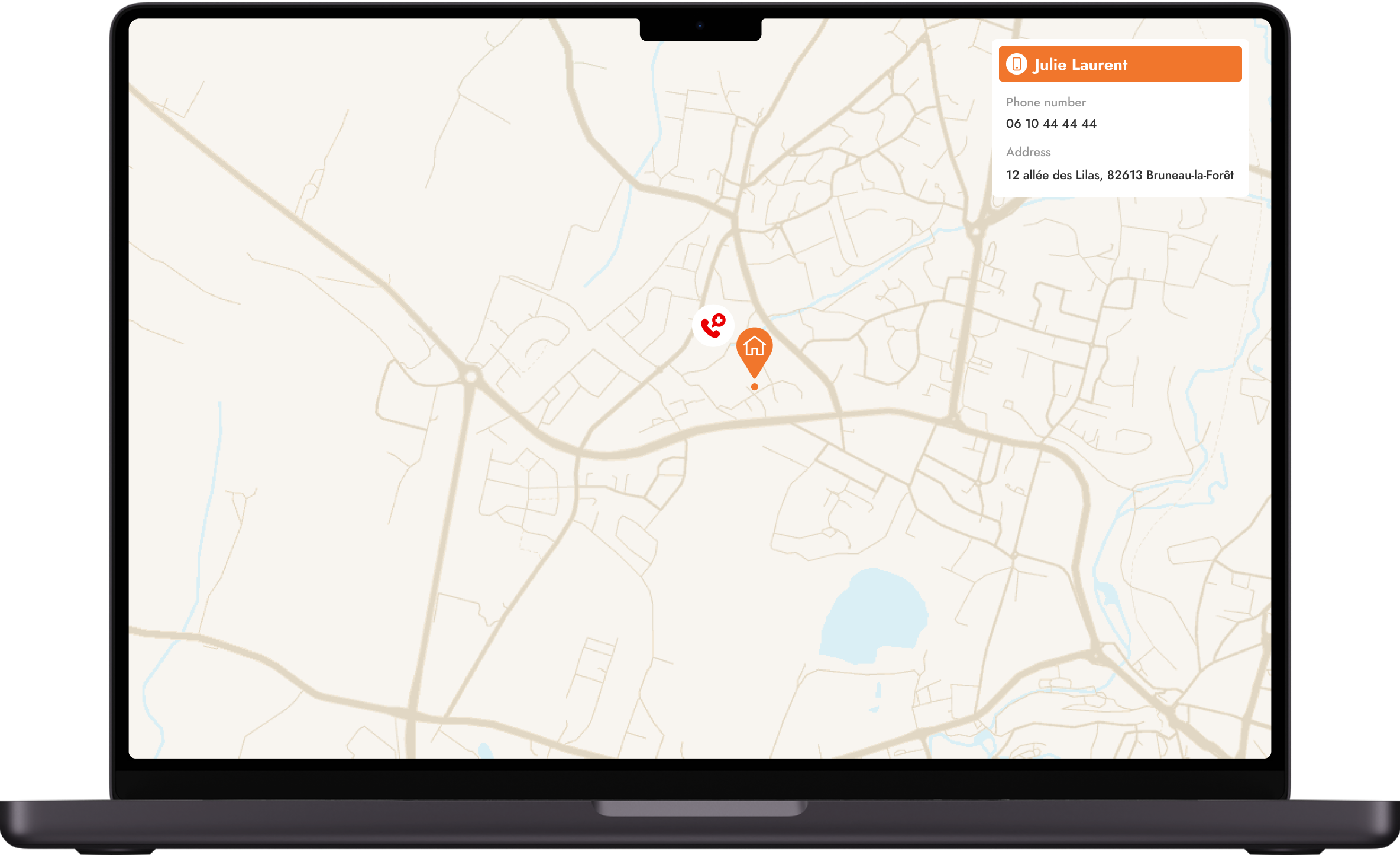
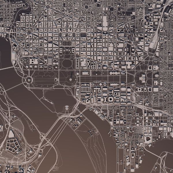
Location and activity insights must be 100% reliable to effectively support public authorities in population alerting, emergency call location, and LEA investigations. Our unparalleled geolocation and unique capabilities at a country-wide scale enhance situational awareness and enable more effective crisis response.

Subscriber regulations
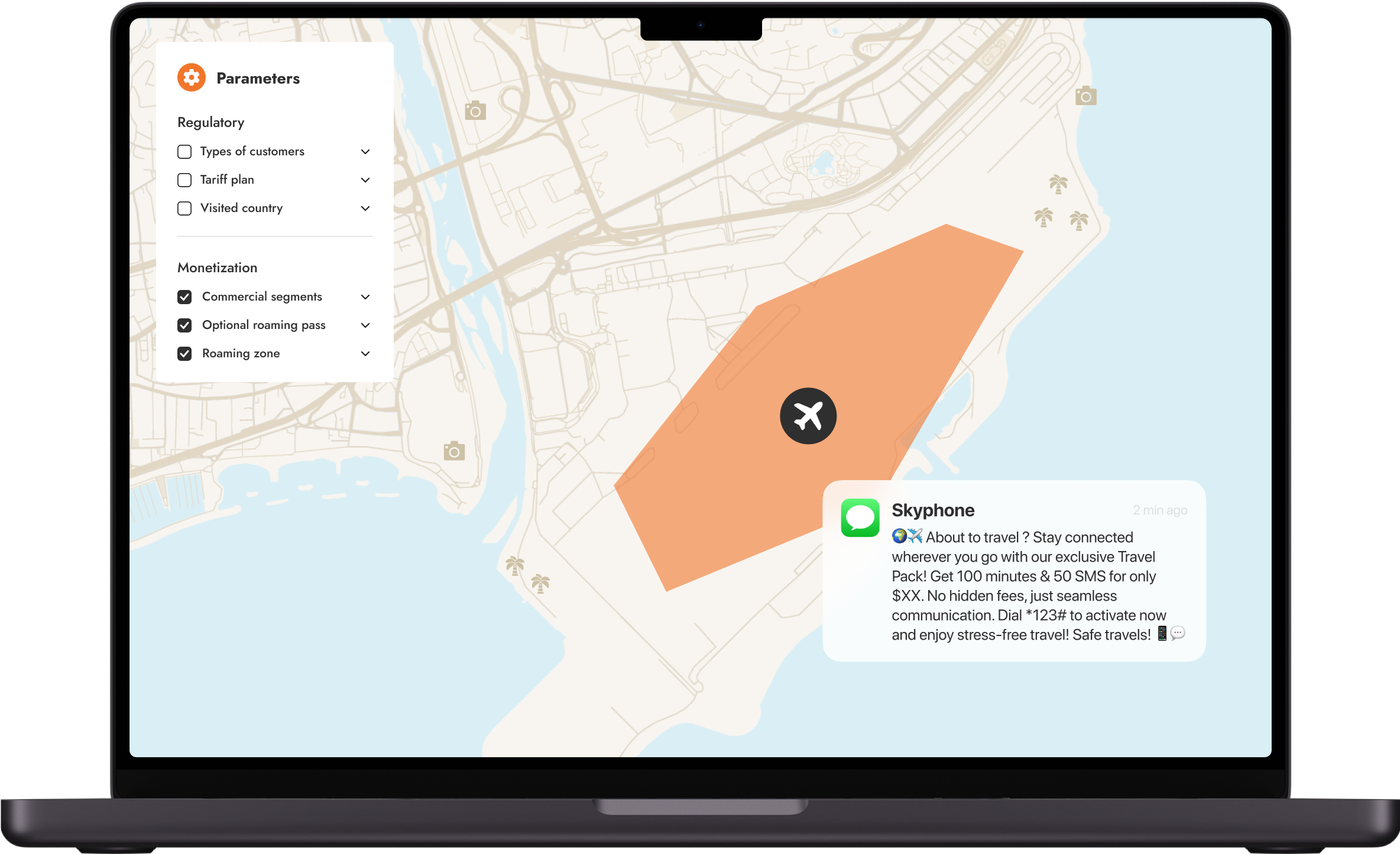
We provide robust data protection and compliance tools to help regulatory teams meet subscribers' data privacy regulations and implement mandated services like welcome SMS for roamers. Our solutions enable telecoms to navigate complex legislative landscapes while respecting personal privacy.
The Regulatory Compliance Suite
Standards, regulations & beyond
Geolocation standards
more3GPP/OMA
Our hybrid location platform complies with and relies on 3GPP standards to retrieve mobile data such as 3GPP TS 23.271 which details active geolocation call-flow or others related to protocol description such as 3GPP TS 36.355 or 3GPP TS 44.031 among many others. Intersec exposes API compliant with OMA standards to facilitate the integration with existing MLS (Mobile Location Service) clients. The Intersec GMLC (Gateway Mobile Location Center) implements the MLP protocol (Mobile Location Protocol) to enable location operations (LIF TS 101).
ETSI
As an ETSI member, Intersec participates in enhancing the efficiency, reliability, and security of communication systems. Learn more in ETSI's interview with J.M. Coïc, Intersec CTO.
Network exposure through APIs
moreAs the traditional telecoms model faces growth limitations within network footprints, APIs offer a crucial pathway for operators to expand beyond their boundaries. By providing access to core network capabilities, APIs create new channels for service delivery and revenue generation. This shift enables telecoms to pursue faster growth, tap into OTT platforms, and offer more tailored services to end-users.
CAMARA - The Telco Global API Alliance
Intersec geolocation experts actively contribute to the Device Location API working group for empowering mobile network operators with enhanced location capabilities. With CAMARA's user-friendly APIs, businesses can easily harness the power of location data, enhancing their services and delivering a superior experience to their users. Learn more in this article.
EU Public Safety Regulations
moreEU Regulations
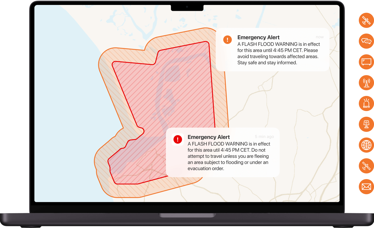
Article 110 for Public Warning Systems requires all EU Member States to be equipped with public warning systems based on telecommunications networks, through cell broadcast and/or location-based SMS technologies.
Delegated Regulation for Emergency Calls: The European Commission issued a directive requiring regulatory authorities to establish the caller location accuracy and reliability criteria for both network-based and handset-derived technologies, to bridge the gap for AML corner cases.
EENA
Intersec is an active EENA member and contributor to help promote the critical importance of advanced public warning systems and next-generation emergency communication solutions (NG112). Our latest articles published on the EENA blog: FR-Alert, a European reference combining Cell Broadcast and Location-Based SMS ; Emergency response in the digital age: why you have to go all in
Global public safety initiatives
moreUN's Early Warnings 4 All initiative
Recognizing the need for a forward-thinking approach aligned with the United Nations’ "Early Warning for All" (EW4All) initiative, Intersec joined the International Telecommunication Union's Development Sector (ITU-D) to guide governments and telecommunications companies in deploying public warning systems and situational awareness solutions to mitigate human losses and physical damages.
CAP
Our Public Warning solutions integrate the CAP protocol, and disseminate alerts simultaneously over multiple communications pathways, globally. They include robust protection measures to guarantee the authenticity of the sender and message integrity, via CAP certificates. Intersec is committed to delivering fully integrated and alerting solutions that are CAP-enabled to standardize alerts and increase warning effectiveness. Intersec endorses the Call to Action on Emergency Alerting and the Emergency Warning Services in the Global Digital Compact.


Featured content

Telecom regulatory compliance for emergency services


Related offerings
Telecom network location

Intersec's hybrid location platform provides valuable location insights and mobility patterns to help telcos adapt to network changes, ensure regulatory compliance, boost revenue, and reduce costs.
Telecom marketing & innovation

Reinvent your value-creation formula to provide the best statistical source anyone could dream of, especially in a post-cookie world, to better understand their own customers' behavior and make smarter decisions.
Get started with Intersec

Some of our prestigious clients


.webp)


.webp)