Civil Protection: Technology for Safety and Resilience
.png)
Monitor. Locate. Alert. Respond.
To maximize the reach and effectiveness of civil protection services, Intersec addresses the specific needs of public authorities, governmental agencies, mission-critical infrastructures, and telecommunication operators, at a national, regional, or local scale, in due respect to data privacy regulations. Our public safety solutions cover 400 million people worldwide and 40% of the population in the European Union.
What's possible for civil protection
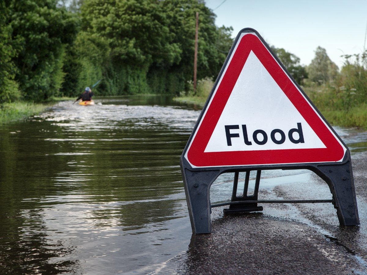
Early warning
Early warning involves detecting hazards and disseminating information for effective response. Intersec processes location-specific data for public safety, offering a comprehensive view and advanced MHEWS with monitoring, alerting, and response, supporting the UN's EW4all initiative.
.jpg?width=6000&height=4000&name=pexels-ono-kosuki-6000157%20(1).jpg)
Public alerting
It takes more than a text to keep people safe. We advocate a multichannel approach, combining cell broadcast and location-based SMS technology, and extending beyond telecom channels, to ensure nearly 100% population coverage. Our public warning solutions currently cover 400 million people worldwide.

Asset management
As soon as an incident is detected, our comprehensive solutions enable crisis managers to swiftly activate their standard operating procedures with ease and efficiency, and promptly inform relevant assets. Additionally, they can send timely, contextualized messages to people at risk during critical situations.

Emergency calls
Our emergency caller location and routing solution leverages network-based plus handset-based location techniques and Advanced Mobile Location (AML) available data, to provide emergency services with critical, certified, up-to-date information and make the most of it in all circumstances.
The GeoSafe Public Safety Software Suite
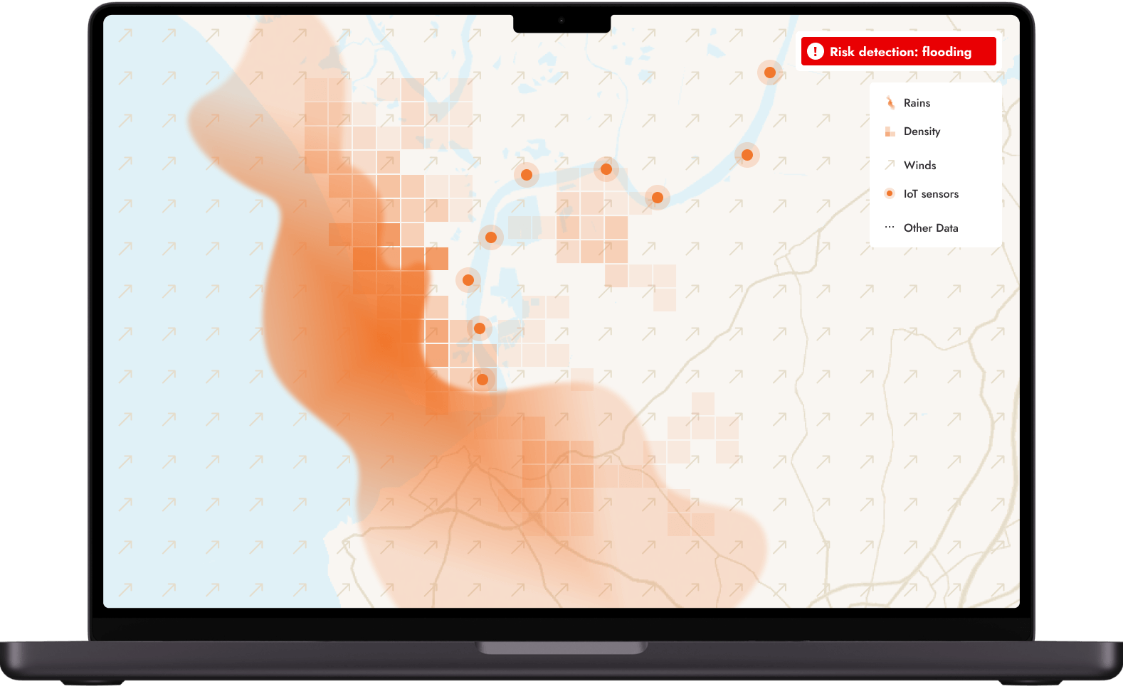
GeoSafe RK
Get it all on a single screen
Our map-centric Risk Knowledge (RK) solution provides comprehensive situational awareness by monitoring global exposure to hazards and incidents. This intuitive platform consolidates diverse data sources into a single user-friendly interface. Leveraging a pre-built, extensive data catalog, it seamlessly displays any data relevant to the user, from CAP-enabled alerts to specialized maps or IoT sensors. Automated alerts can be triggered immediately upon incident detection, customized to meet specific needs and contexts.
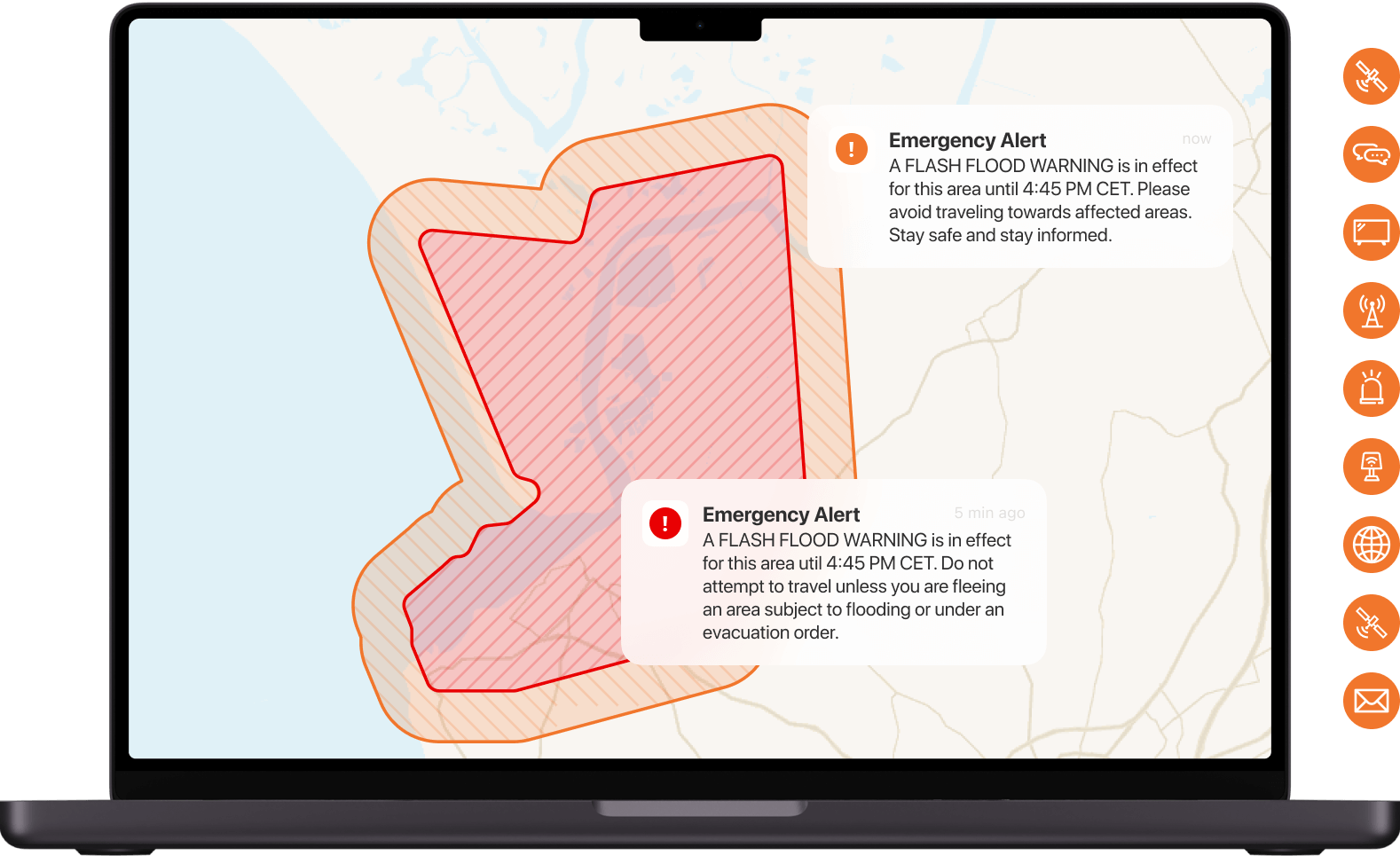
GeoSafe PWS
Alert communities exposed to risks
Our people-centered Public Warning Systems (PWS) help minimize the harm to people, assets, and livelihoods by triggering high-speed, highly contextualized, and geo-targeted alerts across all communication channels (cell broadcast, location-based SMS messages, mobile apps, satellites, social media, TV, radio, websites, sirens...). Our multichannel approach empowers crisis managers to adapt their messaging using live location data and advanced analytics. Our modular and scalable architecture is tailored for governments and mobile carriers.
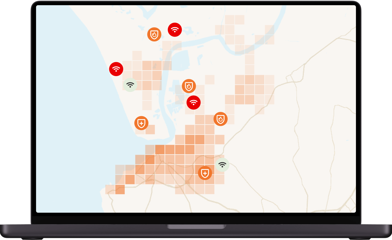
GeoSafe CC
Orchestrate all critical communications
Our Command Center (CC) simplifies taskforce management and ensures clear communication with all stakeholders. It features dynamic location targeting for efficient asset management, advanced contact management for mobilizing your team, and real-time visualizations of assets in danger zones. This enables precise coordination during crises, ensuring timely and effective responses by providing a centralized platform for managing resources, communicating with personnel, and monitoring unfolding situations.
GeoSafe EC
Locate all emergency callers
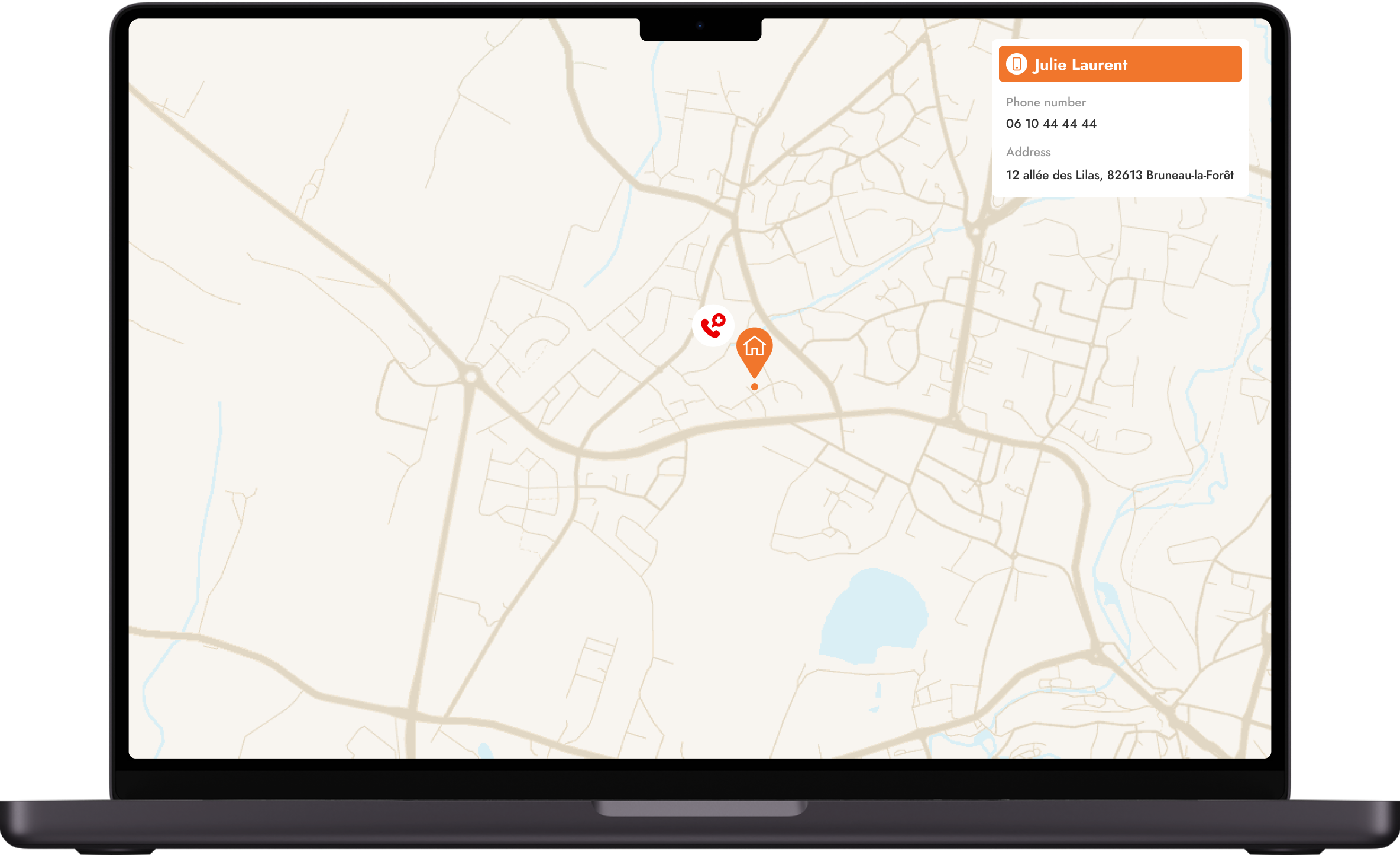
As technology develops, so does our ability to respond to emergency calls (EC). Combining positioning technologies not only accurately routes the call or SMS to the most relevant PSAP, but, most importantly, ensures the reliability and accuracy of the location information, whether the caller's phone is equipped with AML or not. In other words, AML-related data combined with MNO-originated location ensures that the most accurate and reliable location information is reported and that no one is left behind.
The data and tools that matter to you
Ready-to-use applications from Day 1
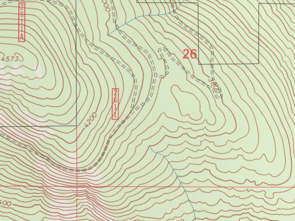
moreThrough open data, our solutions offer a dynamic cartographic display that enhances situational awareness, ensuring users see data specifically relevant to their unique crisis management needs. With a ready-to-use catalog of layers, public safety stakeholders can easily pick and choose the specific data they want to display. Our solutions allow seamless integration with any open data source through APIs, empowering users to access and analyze a wealth of information of interest to them to enhance their decision-making capabilities.
Scalable to address your unique reality
moreIntegrating closed-source data tailored to specific contexts can further enhance the management of emergencies. By incorporating data from external systems, such as weather forecasting subscriptions, IoT sensors, or specialized maps, users can access highly accurate and relevant information to their unique realities. This flexibility ensures that the system adapts to the specific needs and challenges of the user, providing a comprehensive and adaptable solution for enhanced situational awareness.
End-to-end crisis management with network data
moreTo achieve the most comprehensive mission-critical communications, integrating network data from Mobile Network Operators (MNOs) is a crucial step. By tapping into the vast network of MNOs, crisis managers access a digital twin of the in-situ field situation, in real-time and at scale to guide field operations and generate rapid decisions. Moreover, as people increasingly rely on mobile devices for information and communication, leveraging MNO data ensures that communications remain relevant and effective in the long term. By combining the power of open data, closed-source data, and network data, our solutions offer unparalleled reach and effectiveness in emergency management.

Key capabilities
40 geolocation techniques
Real-time population density
Message builder
Cell broadcast & Location-based SMS
Multichannel approach & CAP-compliant
Mobile applications
40 geolocation techniques
Real-time population density
Message builder
Cell broadcast & Location-based SMS
Multichannel approach & CAP-compliant
Mobile applications
We were attracted by the completeness of Intersec's solution, by its experience in delivering messages on a very large scale depending on the real-time location of recipients, and by the willingness of its teams to keep this solution at the cutting edge of technology over the years to come.
”Romain Moutard
Program Director, French Ministry of the Interior
Featured content

Intersec makes pledge to ITU’s Partner2Connect digital coalition
Civil protection use cases
Situational awareness

Our situational awareness instruments serve both authorities and private organizations by providing crisis managers with a real-time digital twin of the in-situ field situation.
Mass notification

Intersec provides a comprehensive, multi-channel application specifically designed for emergency mass notifications to enhance the reach and effectiveness of alerts for individuals at risk.
Incident response

In case of an incident, closely monitor ongoing situations and coordinate your communications with field agents and at-risk communities.
Emergency call location

Our emergency call location solution combines multidimensional cellular device locating capabilities to provide PSAPs with critical, certified, up-to-date location information, for all callers..
QUESTIONS
Frequently asked questions
How does Intersec contribute to public safety?
moreAcross the globe, natural disasters are expected to increase in both severity and frequency, causing devastating impacts on communities, including heavy human tolls, displaced populations, and significant economic losses. These challenges also have profound implications for international security and peace. Addressing these issues is a top priority and lies at the heart of the United Nations Sustainable Development Goals (SDGs).
Intersec plays a fundamental role in supporting these SDGs by equipping nations with cutting-edge, sovereign technological capabilities tailored for all stakeholders in public and national security, from government agencies and mission-critical organizations to civil protection and homeland security departments.
As International Telecommunication Union (ITU) member, Intersec has announced a significant pledge to the Partner2Connect Digital Coalition (P2C), aiming to accelerate the deployment of mobile-enabled Early Warning Systems (EWS) worldwide, in line with the United Nations’ Early Warning for All initiative (EW4All).
What are some real-world examples of how Intersec contributes to public safety?
more-
In Croatia, the government deployed a new national public warning system using a combination of Cell Broadcast and location-based SMS to reach nearly 100% of the population during emergencies. The system enables more effective crisis management through live heatmaps, retargeting capabilities, and highly contextualized communications.
-
In Thailand, at the height of the Covid-19 pandemic, True Digital provided Asia-Pacific authorities with instantaneous and precise location data to visualize people’s movements from clusters in real time on heatmaps, predict scenarios, and streamline medical operations.
-
In England, with an estimated 5.7 million properties at risk of flooding, the country modernized its flood warning system by leveraging advanced early warning and alerting technology, as well as a suite of powerful situational awareness tools, including advanced geographic layers and precise mapping.
What makes Intersec’s technology better for public authorities?
moreIntersec’s technology is distinguished by a unique hybrid expertise that combines deep knowledge of both the telecom and government sectors. This dual perspective enables the development of solutions that are technically robust and closely aligned with the operational and regulatory requirements of public authorities. The Intersec platform, Agora, is designed to serve a wide and diverse range of sovereign use cases, all leveraging the same core technology. This versatility allows authorities to address multiple mission-critical needs efficiently with a unified, scalable solution.
-
In the field of civil protection, Intersec provides tools for early warning, public alerting, and emergency response, enabling authorities to disseminate critical information during crises and adapt their response as situations evolve. Aligned with the United Nations’ Early Warnings for All (EW4All) initiative, Intersec’s early warning systems deliver life-saving alerts during emergencies to minimize casualties and economic losses. These solutions ensure inclusive outreach to remote, rural, and vulnerable populations, offer real-time crisis management features, and support scalable national emergency plans for enhanced preparedness.
-
In the realm of homeland security, Intersec promotes a new, innovative approach to lawful metadata intelligence, striking a balance between security and personal privacy. This enables nations to effectively achieve their security and protection objectives while minimizing the risk of misuse in sensitive contexts.
As a European company, Intersec is acutely aware of data protection regulations and digital sovereignty priorities. The company is committed to geopolitically informed market engagements. Recognizing the dual-use potential of its technologies, Intersec has established stringent sales policies guided by geopolitical considerations. Its market selection process adheres to national, European, and multilateral policies on international security and human rights. Intersec assesses potential markets using data from recognized international organizations and conducts comparative analyses of the rule of law and fundamental rights.
Get started with Intersec

We help telcos and public authorities embrace the digital revolution as we believe data transform the way our customers work.
Let us answer your questions and explain how we can help.
Subscribe to our newsletter
Some of our prestigious clients




.webp)


.webp)


